 , NTS -
 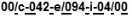 , FPS -
 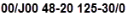 , API -
 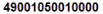 .
.For a list of specific values that control point, line, and region attributes, see Data Type Values Data Type Values.
LAUNCHSPEC |Batchfile Test|x:/bin/batchtest.bat %2|
This optional line launches an external application with specific values from the Open Layers file when an Open Layers object is clicked while Inspecting a map. "Batchfile Test" is the label that appears on the button you click, "x:/bin/batchtest.bat" is the application to launch when the button is clicked, and "%2" is the parameter to pass to the batch file where %2 refers to the value in the third column for a given record (column numbers start at zero).
UWI,STRING,INT,STRING,FLOAT,FLOAT,FLOAT,FILE,ICONID,SIZECATEGORY
The data type definitions. Commas specify the type and order in which to load the data. Data types can be in any order above but the data values in each record below must be in the same order as above.
UWI requires one of the following formats:
DLS xx/xx-xx-xxx-xxWx/x
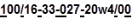
NTS xx/y-xxx-y/xxx-y-xx/x
FPS xx/yxx xx-xx xxx-xx/x
API xxxxxxxxxxxxxx
Where x is a number and y is a letter. AccuMap requires UWIs formatted as follows, with optional characters colored green: DLS - , NTS - , FPS - , API - .
You can replace the UWI column above with columns for latitude and longitude instead. LATITUDE and LONGITUDE use time or decimal degrees format with up to five decimal places for an accuracy of about 1.12 meters on the Earth's surface.
ICONID is the optional symbol to display for the point, and can be any of the following Open Layers Points Icon Chart. SIZECATEGORY is an optional specification for the size of the symbol and can be values of either 0 (small), 1 (medium), or 2 (large).
Well UWI,Well Name,Project No.,Status,KB Elev.,Ground Elev.,TVD,Report,,
These labels describe an inspected or posted point object’s data. Each label corresponds to a data type in the data definition record above. Labels are not required for each data type, but missing labels must still be marked with a comma. Labels for unsupported data types are ignored.
00/14-06-042-25W4/0,Sniffer 1,1264,Gas Flow,747.2,743.8,739.1,Sniffer_1.doc,105
This data record defines a single point object. Each data field in the record is defined by its corresponding data type and label in the data type definition and label records above. Some data fields can be blank, but missing data must still be marked with a comma. In this record, 100/14-06-042-25W4/0 is the point object’s UWI, Sniffer 1 is its Well name, 1264 is its Project No., Sniffer_1.doc is a Word document that can be launched from the point object’s data card, and 105 is AccuMap’s symbol for a gas well.
00/11-08-042-25W4/0,Sniffer 2,1265,Gas Flow,745.9,740.1,735.7,Sniffer_2.doc,105